
 Continue with onX Maps
 Sign in with Facebook


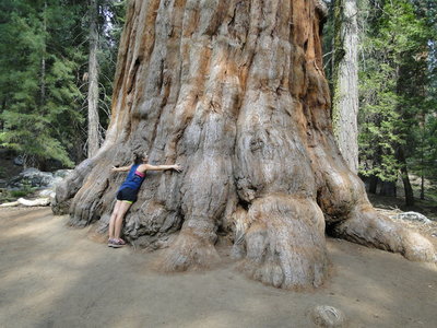
 Particularly Special Place


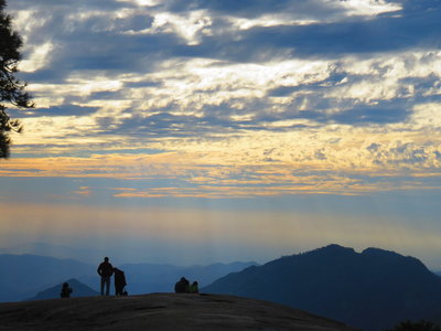
Family Friendly Hiking Trails
near Woodlake, California
Woodlake, California 
Recommended Routes, Photos, & More


 Intermediate
Tokopah Falls Trail
1.9 mi 3.1 km • 580' Up 176.73 m Up • 2' Down 0.72 m Down

 Three R…, CA

 Easy
Easy
General Grant Tree Trail
0.5 mi 0.8 km • 56' Up 17.08 m Up • 53' Down 16.19 m Down
 Intermediate
Lewis Creek Trail
2.9 mi 4.6 km • 905' Up 275.82 m Up • 118' Down 35.83 m Down
Oakhurst, CA
 Intermediate
Discovery Trail
1.0 mi 1.6 km • 277' Up 84.58 m Up • 268' Down 81.59 m Down
Dixon L…, CA

 Difficult
Eagle Lake Trail
1.4 mi 2.2 km • 1,022' Up 311.44 m Up • 8' Down 2.45 m Down
Three R…, CA
 Intermediate
Grizzly Giant Trail
0.6 mi 1.0 km • 300' Up 91.29 m Up • 0' Down 0 m Down
Oakhurst, CA

 Intermediate/Difficult
Sabrina Basin Trail #3101
6.0 mi 9.6 km • 2,061' Up 628.22 m Up • 94' Down 28.64 m Down
West Bi…, CA
 Intermediate
Dogtooth Peak Trail
0.7 mi 1.2 km • 189' Up 57.53 m Up • 0' Down 0 m Down
Auberry, CA
 Easy
Easy
Big Trees Trail
0.7 mi 1.2 km • 63' Up 19.13 m Up • 67' Down 20.3 m Down
Three R…, CA
 Intermediate/Difficult
Middle Fork Kaweah Trail
13.4 mi 21.5 km • 4,195' Up 1278.77 m Up • 947' Down 288.57 m Down
Three R…, CA
 Intermediate
Potwisha-Middle Fork
0.3 mi 0.5 km • 106' Up 32.21 m Up • 30' Down 9.24 m Down
Three R…, CA

 Easy/Intermediate
Hagen Canyon
0.8 mi 1.3 km • 31' Up 9.34 m Up • 31' Down 9.57 m Down
Califor…, CA
 Easy/Intermediate
Sunset Rock Trail
0.8 mi 1.3 km • 84' Up 25.53 m Up • 73' Down 22.39 m Down
Three R…, CA
 Intermediate
Buena Vista Trail
0.9 mi 1.4 km • 278' Up 84.62 m Up • 48' Down 14.69 m Down
Three R…, CA
 Intermediate
Upper Rock Creek Canyon Trail
3.7 mi 5.9 km • 836' Up 254.76 m Up • 16' Down 4.9 m Down
West Bi…, CA
 Intermediate
Crescent Meadow-Tharps Log Trail
0.9 mi 1.5 km • 129' Up 39.25 m Up • 169' Down 51.45 m Down
Three R…, CA
 Intermediate
Hilton Lakes
5.2 mi 8.4 km • 723' Up 220.34 m Up • 707' Down 215.54 m Down
 Intermediate/Difficult
Lady Lake
0.8 mi 1.3 km • 130' Up 39.56 m Up • 1' Down 0.27 m Down
 Easy
Easy
Beetle Rock Sidewalk Trail
0.3 mi 0.4 km • 13' Up 3.87 m Up • 33' Down 9.96 m Down
 Difficult
Matlock Lake Trail
0.5 mi 0.9 km • 111' Up 33.93 m Up • 87' Down 26.5 m Down
 Intermediate/Difficult
Tuttle Creek Trail
1.9 mi 3.1 km • 1,349' Up 411.23 m Up • 16' Down 4.76 m Down
 Intermediate
Charlotte Lake Trail
1.1 mi 1.7 km • 7' Up 1.99 m Up • 316' Down 96.43 m Down
 Intermediate
Blue Oak Trail
3.3 mi 5.3 km • 42' Up 12.91 m Up • 47' Down 14.34 m Down
 Easy/Intermediate
Faithful Couple to Outer Loop Trail (East)
0.5 mi 0.8 km • 12' Up 3.59 m Up • 80' Down 24.34 m Down
 No Photos
Easy
No Photos
Easy
Wawona Meadow Loop Trail
3.3 mi 5.2 km • 346' Up 105.53 m Up • 401' Down 122.1 m Down
 Easy
Easy
Hidden Homes Nature Trail
0.5 mi 0.7 km • 0' Up 0.13 m Up • 0' Down 0.13 m Down
 Intermediate
North Grove Loop
0.9 mi 1.4 km • 78' Up 23.84 m Up • 261' Down 79.61 m Down
 Intermediate
California Tunnel Tree to Outer Loop Trail
0.6 mi 1.0 km • 67' Up 20.55 m Up • 71' Down 21.53 m Down


