
 Continue with onX Maps
 Sign in with Facebook


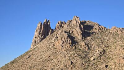
 Particularly Special Place


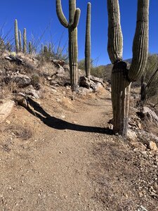
Newest Hiking Trails
near Vaiva Vo, Arizona
Vaiva Vo, Arizona 
Recommended Routes, Photos, & More

 No Photos
 Intermediate
Silverhawke Spur/Palisades
0.7 mi 1.2 km • 11' Up 3.49 m Up • 88' Down 26.75 m Down

 Intermediate
Silverbell Lookout Trail
0.7 mi 1.1 km • 411' Up 125.41 m Up • 3' Down 0.91 m Down
Avra Va…, AZ
No Photos
 Intermediate/Difficult
Saddleback Mountain
1.3 mi 2.2 km • 1,355' Up 413.03 m Up • 109' Down 33.24 m Down
 Intermediate
Perl Charles Memorial #1A
6.2 mi 9.9 km • 1,053' Up 320.98 m Up • 1,000' Down 304.67 m Down
No Photos
Intermediate
Zipper
1.7 mi 2.8 km • 27' Up 8.11 m Up • 213' Down 64.77 m Down
No Photos
 Difficult
Dixie Peak West
0.8 mi 1.3 km • 594' Up 181.06 m Up • 4' Down 1.13 m Down
Paradis…, AZ
No Photos
 Easy
Easy
L.V. Yates Access
0.9 mi 1.4 km • 187' Up 56.99 m Up • 78' Down 23.74 m Down
 Intermediate/Difficult
Saddleback Mountain Backside
1.0 mi 1.6 km • 392' Up 119.62 m Up • 16' Down 4.83 m Down
No Photos
Intermediate/Difficult
Tabletop Trail
4.5 mi 7.2 km • 2,192' Up 668.19 m Up • 163' Down 49.53 m Down
 Intermediate
Tanque Verde Rim Loop
2.0 mi 3.2 km • 278' Up 84.88 m Up • 276' Down 84.27 m Down
Tanque…, AZ
No Photos
Intermediate
CDO Ridge
1.6 mi 2.5 km • 364' Up 111.05 m Up • 37' Down 11.4 m Down
No Photos
Difficult
Scorpion Connector
0.3 mi 0.5 km • 30' Up 9.09 m Up • 9' Down 2.71 m Down
No Photos
Difficult
Scorpion Trail
2.4 mi 3.8 km • 163' Up 49.57 m Up • 53' Down 16.15 m Down
No Photos
Difficult
Snake Eyes Trail
1.2 mi 1.9 km • 94' Up 28.55 m Up • 16' Down 4.84 m Down
 Intermediate/Difficult
Walkin Jim Trail
8.8 mi 14.1 km • 966' Up 294.54 m Up • 966' Down 294.39 m Down
 New River, AZ
 Easy
Easy
Cholla Trail
2.1 mi 3.4 km • 123' Up 37.5 m Up • 237' Down 72.12 m Down
No Photos
Intermediate/Difficult
Forest Rd 4445 Connector
0.5 mi 0.8 km • 242' Up 73.62 m Up • 0' Down 0 m Down
No Photos
Intermediate/Difficult
Sanctuary Loop Trail
1.1 mi 1.7 km • 1' Up 0.24 m Up • 447' Down 136.36 m Down
 Intermediate
Hackberry Spring Loop
3.3 mi 5.4 km • 302' Up 92.09 m Up • 428' Down 130.58 m Down
Intermediate
Second Water and Hackberry Spring Loop
5.2 mi 8.4 km • 579' Up 176.45 m Up • 576' Down 175.51 m Down
Apache…, AZ
No Photos
Intermediate/Difficult
Lutz Canyon Trail
2.9 mi 4.7 km • 2,714' Up 827.31 m Up • 0' Down 0 m Down
 Very Difficult
Hieroglyphic Trail to Superstition Ridgeline
1.3 mi 2.1 km • 1,642' Up 500.6 m Up • 0' Down 0 m Down
 Very Difficult
Old Thompson Peak Trail
1.2 mi 2.0 km • 1,399' Up 426.45 m Up • 4' Down 1.15 m Down
No Photos
Easy
Reach 11 Trail: 56th St to Scottsdale Rd
2.5 mi 4.1 km • 37' Up 11.41 m Up • 21' Down 6.47 m Down
No Photos
Easy
Reach 11 Trail: Cave Creek Rd to Tatum Blvd
4.9 mi 7.9 km • 36' Up 10.93 m Up • 43' Down 13.2 m Down
No Photos
 Easy/Intermediate
Maricopa Trail: I-17 to Spear S Ranch Trailhead
6.6 mi 10.7 km • 386' Up 117.56 m Up • 69' Down 21.16 m Down
No Photos
Easy/Intermediate
Axle Grease Trail
2.2 mi 3.5 km • 99' Up 30.12 m Up • 40' Down 12.33 m Down
 Difficult
Old Sawmill Spring Trail #126
0.8 mi 1.2 km • 440' Up 134.08 m Up • 0' Down 0 m Down


