
 Continue with onX Maps
 Sign in with Facebook


 Particularly Special Place


Noteworthy Backpacking Routes
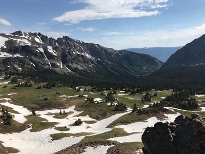
near Hayden, Colorado
Hayden, Colorado 
Recommended Routes, Photos, & More

 Intermediate/Difficult
Buffalo Mountain Loop
13.4 mi 21.6 km • 2,976' Up 907.08 m Up • 2,960' Down 902.3 m Down

 Silvert…, CO
 Difficult
Mount of the Holy Cross
11.1 mi 17.9 km • 5,289' Up 1612.02 m Up • 5,289' Down 1611.95 m Down
Minturn, CO
 Intermediate/Difficult
Zirkel Circle
10.4 mi 16.8 km • 2,360' Up 719.41 m Up • 2,363' Down 720.25 m Down
Steambo…, CO
 Intermediate/Difficult
Fancy Pass to Missouri Lakes Loop
8.8 mi 14.2 km • 2,449' Up 746.43 m Up • 2,449' Down 746.32 m Down
Minturn, CO
 Difficult
Baker Gulch to Bowen Lake
19.9 mi 32.0 km • 4,483' Up 1366.38 m Up • 4,483' Down 1366.29 m Down
Grand Lake, CO
 Intermediate/Difficult
Booth Lake Trail Out and Back
8.9 mi 14.3 km • 3,034' Up 924.84 m Up • 3,034' Down 924.86 m Down
Vail, CO
 Intermediate/Difficult
Colorado Trail: Copper Mountain to Camp Hale
18.7 mi 30.1 km • 3,010' Up 917.31 m Up • 3,440' Down 1048.64 m Down
Copper…, CO
 Difficult
CT - Segment 7: Goldhill to Copper Mountain
13.1 mi 21.1 km • 3,650' Up 1112.57 m Up • 3,026' Down 922.31 m Down
Brecken…, CO

 Intermediate
Rainbow Lake
8.5 mi 13.7 km • 1,376' Up 419.46 m Up • 1,376' Down 419.49 m Down
Walden, CO
 Intermediate/Difficult
Devil's Causeway Loop
10.7 mi 17.2 km • 1,775' Up 541.14 m Up • 1,776' Down 541.24 m Down
Gypsum, CO
 Intermediate/Difficult
Colorado Trail (CT)
487.3 mi 784.3 km • 83,178' Up 25352.6 m Up • 81,864' Down 24952.2 m Down
Roxboro…, CO
 Intermediate/Difficult
Upper Cataract Lake Out and Back
10.4 mi 16.8 km • 2,510' Up 765.14 m Up • 2,510' Down 764.95 m Down
Vail, CO
 Intermediate
CT - Segment 9: Tennessee Pass to Timberline Lake
13.3 mi 21.3 km • 2,297' Up 700.05 m Up • 2,674' Down 814.99 m Down
Leadvil…, CO
 Intermediate
Moffat Tunnel (East Portal) to Winter Park
18.5 mi 29.8 km • 2,912' Up 887.67 m Up • 3,386' Down 1032.15 m Down
Winter…, CO
 Difficult
New York Mountain to Nolan Lake to Peter Estin Hut
14.7 mi 23.7 km • 3,431' Up 1045.73 m Up • 3,576' Down 1090.1 m Down
Edwards, CO
Intermediate
CDT: Timberline Lake to Tennessee Pass (CO Sec. 25)
13.3 mi 21.4 km • 2,727' Up 831.06 m Up • 2,324' Down 708.47 m Down
Leadvil…, CO
Difficult
Devils Causeway-Lost Lakes-Chinese Wall
22.8 mi 36.8 km • 4,282' Up 1305.02 m Up • 4,284' Down 1305.8 m Down
Gypsum, CO
 Intermediate
Wyoming Trail to Lake Elmo
14.7 mi 23.6 km • 1,301' Up 396.45 m Up • 1,301' Down 396.47 m Down
Steambo…, CO
 No Photos
Intermediate
No Photos
Intermediate
Lake Evelyn Out-and-Back
4.7 mi 7.6 km • 1,174' Up 357.8 m Up • 1,174' Down 357.78 m Down
Winter…, CO
 Intermediate/Difficult
Long Eaglesmere - Upper Cateract - Surprise Lake Loop
25.3 mi 40.8 km • 4,232' Up 1289.84 m Up • 4,424' Down 1348.56 m Down
Vail, CO
 Intermediate/Difficult
Carey/Island Lakes Out-and-Back
14.4 mi 23.1 km • 2,669' Up 813.41 m Up • 2,669' Down 813.39 m Down
Red Fea…, CO
Intermediate
CDT: Rabbit Ears Pass to Buffalo Pass (CO Sec. 41)
15.7 mi 25.2 km • 1,723' Up 525.27 m Up • 970' Down 295.62 m Down
Steambo…, CO
 Difficult
Berthoud Ridge Traverse
43.0 mi 69.3 km • 13,386' Up 4080.02 m Up • 13,375' Down 4076.73 m Down
Winter…, CO
 Intermediate/Difficult
Indian Peaks Traverse (IPT)
71.2 mi 114.6 km • 9,173' Up 2796.02 m Up • 5,813' Down 1771.92 m Down
Boulder, CO
 Difficult
Colorado Trail: Georgia Pass to Breckenridge
20.3 mi 32.8 km • 4,353' Up 1326.78 m Up • 1,776' Down 541.44 m Down
Brecken…, CO
No Photos
Intermediate/Difficult
St. Louis Lake Trail
6.0 mi 9.7 km • 1,406' Up 428.48 m Up • 1,405' Down 428.38 m Down
 Intermediate/Difficult
Gore Lake Out & Back
11.9 mi 19.1 km • 2,593' Up 790.49 m Up • 2,594' Down 790.5 m Down


