
 Continue with onX Maps
 Sign in with Facebook


 Particularly Special Place


Top Recommended Hiking Routes
near Helena Valley Northwest, Montana
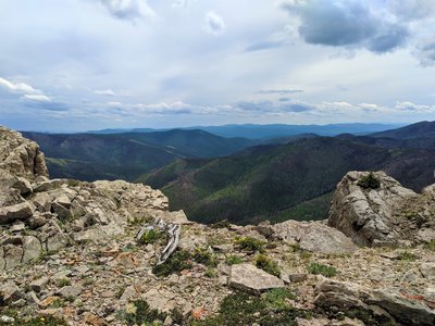
Helena Valley Northwest, Montana 
Recommended Routes, Photos, & More


 Difficult
Bridger Ridge Traverse
18.7 mi 30.1 km • 4,060' Up 1237.47 m Up • 6,840' Down 2084.7 m Down
 Bozeman, MT

 Intermediate
Drinking Horse Mountain
2.3 mi 3.7 km • 643' Up 196.07 m Up • 643' Down 196.03 m Down
 Bozeman, MT
 Intermediate
Sypes Canyon Trail
6.4 mi 10.3 km • 1,599' Up 487.52 m Up • 1,599' Down 487.36 m Down
Bozeman, MT
 Intermediate
Crow Creek Falls Trail
5.9 mi 9.5 km • 896' Up 273.1 m Up • 896' Down 273.01 m Down
Townsend, MT
 No Photos
 Intermediate/Difficult
Truman Gulch
4.8 mi 7.8 km • 1,281' Up 390.37 m Up • 1,282' Down 390.75 m Down
Bozeman, MT
No Photos
Difficult
Big Baldy Mountain Loop
16.9 mi 27.3 km • 4,093' Up 1247.58 m Up • 4,345' Down 1324.37 m Down
Stanford, MT
 Difficult
Sacagawea Peak
4.2 mi 6.8 km • 1,794' Up 546.91 m Up • 1,793' Down 546.43 m Down
Bozeman, MT
 Difficult
Bridger Ridge Traverse 2.0 (M to Corbly)
25.9 mi 41.6 km • 8,533' Up 2600.99 m Up • 8,128' Down 2477.29 m Down
Bozeman, MT
 Difficult
Baldy Mountain
10.9 mi 17.6 km • 3,837' Up 1169.65 m Up • 3,837' Down 1169.42 m Down
 Intermediate
Bozeman "M" Out-and-Back
1.9 mi 3.1 km • 811' Up 247.05 m Up • 810' Down 246.89 m Down
 Intermediate/Difficult
North Cottonwood Loop
4.1 mi 6.6 km • 874' Up 266.28 m Up • 873' Down 266.07 m Down
No Photos
Intermediate/Difficult
Montana Trail Sec. 18: Checkerboard to Geyser
86.4 mi 139.1 km • 11,176' Up 3406.53 m Up • 12,221' Down 3724.92 m Down
 Intermediate
Grassy Mountain
9.7 mi 15.6 km • 1,788' Up 545.07 m Up • 1,788' Down 544.93 m Down
 Intermediate
Maud S. Loop
4.3 mi 7.0 km • 943' Up 287.41 m Up • 946' Down 288.43 m Down
 Difficult
Highwood Baldy Out-and-Back
6.2 mi 9.9 km • 3,191' Up 972.56 m Up • 3,191' Down 972.47 m Down
 Intermediate/Difficult
Lost Creek Trail
11.2 mi 18.0 km • 1,443' Up 439.87 m Up • 1,441' Down 439.33 m Down
No Photos
Intermediate
Montana Trail Sec. 9: Wise River to Badger Pass
73.4 mi 118.1 km • 11,444' Up 3488.25 m Up • 10,359' Down 3157.51 m Down
No Photos
Intermediate
Montana Trail Sec. 7: Homestake Pass/Butte (CDT/MT406 Junction)
57.1 mi 91.9 km • 9,372' Up 2856.44 m Up • 7,482' Down 2280.66 m Down
No Photos
Intermediate
Montana Trail Sec. 6 McDonald Pass to Homestake Pass
103.7 mi 166.8 km • 14,837' Up 4522.45 m Up • 14,797' Down 4510.24 m Down
No Photos
Intermediate
Montana Trail Sec. 5: Rogers Pass to McDonald Pass
71.5 mi 115.1 km • 14,122' Up 4304.3 m Up • 13,411' Down 4087.8 m Down
 Intermediate
Montana Trail Sec. 4: Benchmark to Rogers Pass
59.7 mi 96.0 km • 11,018' Up 3358.17 m Up • 10,651' Down 3246.31 m Down
 Intermediate
Montana Trail Sec. 16: Livingston to Lennep
97.0 mi 156.1 km • 10,073' Up 3070.2 m Up • 9,309' Down 2837.52 m Down
No Photos
Intermediate
Montana Trail Sec. 17: Lennep to Checkerboard
26.1 mi 42.1 km • 2,819' Up 859.22 m Up • 2,808' Down 855.93 m Down
Intermediate
Montana Trail Sec. 19: Geyser to Highwood
40.4 mi 65.0 km • 4,415' Up 1345.58 m Up • 5,222' Down 1591.69 m Down
No Photos
Intermediate
Montana Trail Sec. 20: Highwood to Fort Benton
21.8 mi 35.1 km • 475' Up 144.77 m Up • 1,232' Down 375.39 m Down

