
 Continue with onX Maps
 Sign in with Facebook


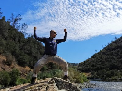
 Particularly Special Place


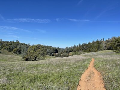
Top Recommended Hiking Routes
near Butte Valley, California
Butte Valley, California 
Recommended Routes, Photos, & More


 Intermediate/Difficult
Stevens Trail
7.7 mi 12.4 km • 1,275' Up 388.71 m Up • 1,276' Down 388.84 m Down

 Colfax, CA

 Difficult
Pyramid Peak - Rocky Canyon Trail
6.5 mi 10.5 km • 3,915' Up 1193.24 m Up • 3,913' Down 1192.8 m Down
South L…, CA
 Difficult
Stebbins Cold Canyon Loop
5.1 mi 8.2 km • 1,413' Up 430.73 m Up • 1,409' Down 429.51 m Down
Winters, CA

 Intermediate
Mt. Judah Loop
5.6 mi 9.1 km • 1,228' Up 374.37 m Up • 1,227' Down 374.11 m Down
Truckee, CA
 Intermediate/Difficult
Loch Leven Trail
7.8 mi 12.5 km • 1,474' Up 449.2 m Up • 1,474' Down 449.27 m Down
Truckee, CA
 Difficult
Shirley Canyon Trail
5.8 mi 9.4 km • 1,899' Up 578.74 m Up • 1,898' Down 578.66 m Down
Sunnysi…, CA
 Difficult
Castle Peak Summit
5.9 mi 9.5 km • 1,768' Up 538.81 m Up • 1,768' Down 538.89 m Down
Truckee, CA
 Intermediate
Cronan Ranch Loop
6.2 mi 10.1 km • 771' Up 234.94 m Up • 760' Down 231.53 m Down
Pilot Hill, CA
 Intermediate/Difficult
PCT: Echo Lake to Interstate 80 (Donner Summit)
65.2 mi 104.9 km • 9,230' Up 2813.17 m Up • 9,462' Down 2884.04 m Down
South L…, CA
 Intermediate/Difficult
Sierra Buttes
4.8 mi 7.7 km • 1,494' Up 455.26 m Up • 1,493' Down 454.95 m Down
Downiev…, CA
 Intermediate
Tour de Table Mountain - Phantom Falls Loop
6.9 mi 11.1 km • 783' Up 238.69 m Up • 783' Down 238.51 m Down
Oroville, CA
 Intermediate
Fleming Meadow Trail #8
7.2 mi 11.7 km • 1,018' Up 310.14 m Up • 1,024' Down 312.09 m Down
Pollock…, CA

 Easy/Intermediate
Nature Loop
1.6 mi 2.5 km • 21' Up 6.29 m Up • 20' Down 6.23 m Down
Carmichael, CA
 Difficult
Snow Mountain Summits
9.5 mi 15.3 km • 2,131' Up 649.55 m Up • 2,131' Down 649.52 m Down
Lucerne, CA

 Easy
Easy
Bizz Johnson National Recreation Trail
26.3 mi 42.4 km • 295' Up 89.82 m Up • 1,349' Down 411.24 m Down
Westwood, CA
 Intermediate/Difficult
Bidwell Park Tour
14.2 mi 22.9 km • 1,747' Up 532.5 m Up • 1,747' Down 532.57 m Down
Chico, CA
 Intermediate
Shingle Falls
5.3 mi 8.6 km • 538' Up 164 m Up • 538' Down 163.89 m Down
Beale A…, CA
 Intermediate/Difficult
Auburn Overlook Park Western States-Quarry Trails Loop (20 miles)
21.1 mi 33.9 km • 3,215' Up 980.06 m Up • 3,218' Down 980.86 m Down
Auburn, CA
 Intermediate
Foresthill Divide Loop
11.2 mi 18.0 km • 1,087' Up 331.19 m Up • 1,087' Down 331.23 m Down
Auburn…, CA
 Intermediate
Zim Zim Falls
7.8 mi 12.5 km • 634' Up 193.17 m Up • 634' Down 193.16 m Down
Middletown, CA
 Difficult
Bidwell-Guardian Out-and-Back
12.7 mi 20.4 km • 1,123' Up 342.19 m Up • 1,123' Down 342.17 m Down
Chico, CA
 Intermediate
Old Homestead Loop
5.3 mi 8.5 km • 983' Up 299.47 m Up • 983' Down 299.62 m Down
Forest…, CA
 Intermediate
Hidden Falls Loop
8.6 mi 13.8 km • 811' Up 247.31 m Up • 812' Down 247.45 m Down
North A…, CA
 Difficult
Cache Creek Ford
13.1 mi 21.1 km • 1,543' Up 470.38 m Up • 2,288' Down 697.3 m Down
Clearlake, CA
 Easy
Easy
Eagle Lake South Shore
9.2 mi 14.9 km • 91' Up 27.6 m Up • 91' Down 27.6 m Down
Susanville, CA
 Intermediate/Difficult
Rowton Peak Loop
4.5 mi 7.2 km • 890' Up 271.16 m Up • 897' Down 273.43 m Down
Truckee, CA
 Intermediate
Warren Lake Trail to Frog Lake Cliffs
8.6 mi 13.8 km • 1,475' Up 449.72 m Up • 1,475' Down 449.73 m Down
Truckee, CA
 Intermediate
Stanford Rock Trail to the Bench
10.5 mi 16.9 km • 2,114' Up 644.34 m Up • 2,114' Down 644.27 m Down
Sunnysi…, CA


