
 Continue with onX Maps
 Sign in with Facebook


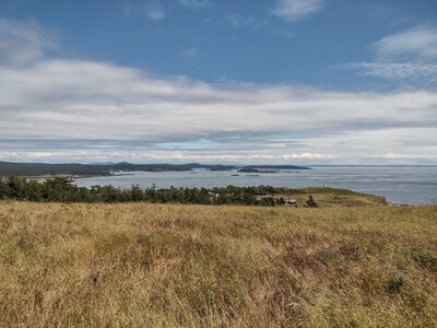
 Particularly Special Place


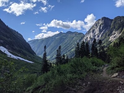
Newest Recommended Hiking Routes
near Surrey, British Columbia Canada
Surrey, British Columbia Canada 
Recommended Routes, Photos, & More


 Difficult
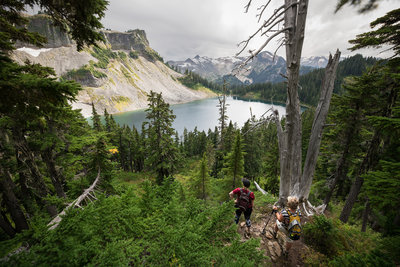
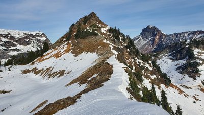
Excelsior Peak
8.3 mi 13.4 km • 3,542' Up 1079.68 m Up • 3,553' Down 1083.06 m Down

 Intermediate
Chain Lakes Loop
6.4 mi 10.3 km • 1,759' Up 536.1 m Up • 1,763' Down 537.26 m Down
Peacefu…, WA
 Difficult
Stawamus Chief -Peak 1
1.3 mi 2.1 km • 1,774' Up 540.79 m Up • 14' Down 4.24 m Down
Squamish, BC

 Intermediate/Difficult
Dock Butte and Blue Lake
5.1 mi 8.3 km • 1,592' Up 485.13 m Up • 1,586' Down 483.5 m Down
 Alger, WA
 Difficult
Park Butte to Railroad Grade
8.1 mi 13.1 km • 2,704' Up 824.25 m Up • 2,704' Down 824.18 m Down
Sudden…, WA
 Intermediate/Difficult
South Baker Lake to Maple Grove Camp
7.4 mi 11.8 km • 906' Up 276.16 m Up • 911' Down 277.66 m Down
Diablo, WA
 Intermediate
Anderson and Watson Lakes
5.5 mi 8.9 km • 1,630' Up 496.78 m Up • 1,629' Down 496.56 m Down
Diablo, WA
 Difficult
Tomyhoi Peak via Keep Kool Trail
13.7 mi 22.0 km • 5,576' Up 1699.65 m Up • 5,536' Down 1687.3 m Down
Peacefu…, WA
 Intermediate/Difficult
Yellow Aster Butte
8.2 mi 13.1 km • 2,596' Up 791.32 m Up • 2,595' Down 790.9 m Down
Peacefu…, WA
 Intermediate/Difficult
A Chuckanut Classic via Raptor Ridge
9.0 mi 14.5 km • 1,816' Up 553.58 m Up • 1,816' Down 553.55 m Down
Bellingham, WA
 Intermediate
Pine and Cedar Lakes Loop
5.8 mi 9.4 km • 1,783' Up 543.52 m Up • 1,785' Down 544.12 m Down
 Intermediate/Difficult
Fragrance Lake
4.1 mi 6.5 km • 1,000' Up 304.67 m Up • 993' Down 302.79 m Down
 Intermediate/Difficult
Chantrelle Full Loop via Hertz Trail
9.7 mi 15.6 km • 2,168' Up 660.83 m Up • 2,180' Down 664.39 m Down
Sudden…, WA
 No Photos
Intermediate
No Photos
Intermediate
Burnout Trail
8.2 mi 13.2 km • 1,697' Up 517.29 m Up • 1,698' Down 517.42 m Down
Bellingham, WA
No Photos
 Easy/Intermediate
Racehorse Falls Trail
0.6 mi 1.0 km • 49' Up 14.89 m Up • 48' Down 14.76 m Down
No Photos
Difficult
Canyon Creek OHV Out-and-Back
31.5 mi 50.7 km • 5,120' Up 1560.62 m Up • 5,117' Down 1559.61 m Down
No Photos
Difficult
Keep Kool Butte
6.3 mi 10.1 km • 2,817' Up 858.69 m Up • 2,816' Down 858.44 m Down
Peacefu…, WA
 Difficult
Elbow Lake - Bell Pass - Ridley Creek Loop
14.1 mi 22.7 km • 3,440' Up 1048.55 m Up • 3,433' Down 1046.43 m Down
Sudden…, WA
 Easy/Intermediate
Mt. Finlayson - Lagoon Loop
3.8 mi 6.2 km • 422' Up 128.62 m Up • 423' Down 128.97 m Down
 Easy/Intermediate
Iva Mann Walk Loop
4.7 mi 7.6 km • 199' Up 60.67 m Up • 198' Down 60.48 m Down
 Easy/Intermediate
Barnum Point Preserve Loop Trail
1.9 mi 3.0 km • 145' Up 44.31 m Up • 160' Down 48.7 m Down
Camano, WA
 Difficult
Copper Ridge Loop
34.6 mi 55.7 km • 8,545' Up 2604.41 m Up • 8,542' Down 2603.53 m Down
Peacefu…, WA
 Intermediate
Four Springs Lake Preserve Loop
1.6 mi 2.5 km • 145' Up 44.27 m Up • 145' Down 44.33 m Down
Camano, WA
 Intermediate
Camano Island Ridge Forest Preserve Loop
2.7 mi 4.4 km • 222' Up 67.54 m Up • 219' Down 66.9 m Down
Camano, WA

 Easy
Easy
Cama Beach Bluff Trail
2.1 mi 3.3 km • 208' Up 63.27 m Up • 208' Down 63.42 m Down
 Intermediate
Main Line Loop
5.1 mi 8.3 km • 487' Up 148.35 m Up • 487' Down 148.33 m Down
 Difficult
Cyprus Circuit
23.5 mi 37.8 km • 6,004' Up 1830 m Up • 6,004' Down 1829.91 m Down
 Intermediate
Ruckle Farm Loop
3.8 mi 6.2 km • 328' Up 100.05 m Up • 329' Down 100.32 m Down
North S…, BC


