
 Continue with onX Maps
 Sign in with Facebook


 Particularly Special Place


Newest Recommended Hiking Routes
near Four Corners, Montana
Four Corners, Montana 
Recommended Routes, Photos, & More


 Intermediate
Montana Trail Sec. 12: West Fork/HWY 287 – Cinnamon Lodge/HWY 191
46.2 mi 74.3 km • 9,025' Up 2750.91 m Up • 8,469' Down 2581.22 m Down

 No Photos
 Intermediate/Difficult
Montana Trail Sec. 11: Lima to West Fork
81.6 mi 131.3 km • 9,641' Up 2938.56 m Up • 9,991' Down 3045.31 m Down
No Photos
Intermediate
Montana Trail Sec. 10: Badger Pass to Lima
82.6 mi 132.9 km • 11,861' Up 3615.17 m Up • 12,345' Down 3762.88 m Down
No Photos
Intermediate
Montana Trail Sec. 7: Homestake Pass/Butte (CDT/MT406 Junction)
57.1 mi 91.9 km • 9,372' Up 2856.44 m Up • 7,482' Down 2280.66 m Down
No Photos
Intermediate
Montana Trail Sec. 6 McDonald Pass to Homestake Pass
103.7 mi 166.8 km • 14,837' Up 4522.45 m Up • 14,797' Down 4510.24 m Down
No Photos
Intermediate
Montana Trail Sec. 5: Rogers Pass to McDonald Pass
71.5 mi 115.1 km • 14,122' Up 4304.3 m Up • 13,411' Down 4087.8 m Down
No Photos
 Easy/Intermediate
Montana Trail Sec. 14
3.8 mi 6.1 km • 386' Up 117.7 m Up • 8' Down 2.34 m Down
 Intermediate
Montana Trail Sec. 15: Chico Hot Springs to Livingston
68.4 mi 110.1 km • 10,601' Up 3231.17 m Up • 11,379' Down 3468.28 m Down
 Intermediate
Montana Trail Sec. 16: Livingston to Lennep
97.0 mi 156.1 km • 10,073' Up 3070.2 m Up • 9,309' Down 2837.52 m Down
No Photos
Intermediate
Montana Trail Sec. 17: Lennep to Checkerboard
26.1 mi 42.1 km • 2,819' Up 859.22 m Up • 2,808' Down 855.93 m Down
No Photos
Intermediate/Difficult
Montana Trail Sec. 18: Checkerboard to Geyser
86.4 mi 139.1 km • 11,176' Up 3406.53 m Up • 12,221' Down 3724.92 m Down
 Intermediate
Grassy Mountain
9.7 mi 15.6 km • 1,788' Up 545.07 m Up • 1,788' Down 544.93 m Down
 Very Difficult
Granite Peak Trail
23.6 mi 37.9 km • 7,401' Up 2255.88 m Up • 7,401' Down 2255.84 m Down
Cooke City, MT

 Difficult
Montana Trail Sec. 13: Cinnamon Lodge to Emigrant
50.2 mi 80.8 km • 6,599' Up 2011.37 m Up • 8,206' Down 2501.06 m Down
Big Sky, MT
 Intermediate/Difficult
North Cottonwood Loop
4.1 mi 6.6 km • 874' Up 266.28 m Up • 873' Down 266.07 m Down
 Intermediate/Difficult
Deep Lake
5.2 mi 8.4 km • 2,567' Up 782.5 m Up • 26' Down 7.97 m Down
Whitehall, MT
 Intermediate
Painted Hills Trail (and Connector Trail)
4.2 mi 6.7 km • 635' Up 193.58 m Up • 184' Down 56.23 m Down
 Difficult
Bridger Ridge Traverse 2.0 (M to Corbly)
25.9 mi 41.6 km • 8,533' Up 2600.99 m Up • 8,128' Down 2477.29 m Down
Bozeman, MT
 Easy/Intermediate
Pine Creek Falls
2.6 mi 4.2 km • 400' Up 121.77 m Up • 399' Down 121.62 m Down
 Livingston, MT
 Difficult
The Hyalite Crusher
20.0 mi 32.2 km • 5,077' Up 1547.59 m Up • 5,114' Down 1558.64 m Down
 Intermediate/Difficult
Big Timber to Blue and Granite Lakes
8.2 mi 13.2 km • 1,927' Up 587.43 m Up • 1,927' Down 587.46 m Down
Big Timber, MT
 Difficult
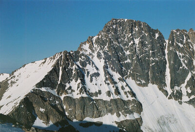
Sphinx Mountain
12.4 mi 19.9 km • 4,728' Up 1441.04 m Up • 4,727' Down 1440.77 m Down
Big Sky, MT

 Easy
Easy
Sourdough Canyon (Bozeman Creek Trail)
3.8 mi 6.1 km • 268' Up 81.61 m Up • 268' Down 81.64 m Down
Bozeman, MT
Difficult
Sacagawea Peak
4.2 mi 6.8 km • 1,794' Up 546.91 m Up • 1,793' Down 546.43 m Down
Bozeman, MT
 Easy
Easy
Palisade Falls
1.2 mi 2.0 km • 227' Up 69.15 m Up • 227' Down 69.1 m Down
Bozeman, MT
 Intermediate
Emerald and Heather Lakes
11.3 mi 18.3 km • 2,131' Up 649.57 m Up • 2,131' Down 649.54 m Down
Bozeman, MT
 Intermediate
Storm Castle
4.9 mi 7.9 km • 1,819' Up 554.53 m Up • 1,819' Down 554.43 m Down
Four Co…, MT
 Intermediate
Triple Tree Trail
5.6 mi 9.1 km • 906' Up 276.15 m Up • 906' Down 276.15 m Down
Bozeman, MT


