
 Continue with onX Maps
 Sign in with Facebook


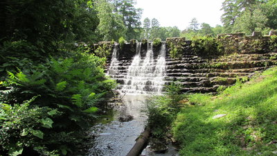
 Particularly Special Place


Family Friendly Hiking Trails
near Austin, Arkansas
Austin, Arkansas 
Recommended Routes, Photos, & More


 Intermediate/Difficult
North Sylamore Creek Trail
23.7 mi 38.1 km • 3,832' Up 1167.91 m Up • 4,525' Down 1379.18 m Down
 Calico…, AR

 Intermediate
Cadron Settlement Trail
5.6 mi 9.0 km • 465' Up 141.86 m Up • 446' Down 135.97 m Down
 Conway, AR
 Intermediate
Sunset Trail (Stonebridge Section)
2.1 mi 3.3 km • 503' Up 153.38 m Up • 210' Down 63.91 m Down
 Intermediate/Difficult
Hideout Hollow Trail
0.9 mi 1.5 km • 76' Up 23.27 m Up • 248' Down 75.74 m Down
 No Photos
 Easy
Easy
Flatwoods Trail
0.8 mi 1.3 km • 17' Up 5.04 m Up • 15' Down 4.48 m Down
No Photos
Easy
Hot Springs Creek Greenway Trail
2.8 mi 4.6 km • 40' Up 12.33 m Up • 169' Down 51.46 m Down
 Easy/Intermediate
Orange Trail
1.2 mi 1.9 km • 154' Up 46.82 m Up • 128' Down 39.16 m Down
No Photos
Easy
Prairie Trail
1.8 mi 2.9 km • 16' Up 4.83 m Up • 12' Down 3.78 m Down
No Photos
Intermediate
Delta Heritage River Trail
21.5 mi 34.6 km • 70' Up 21.25 m Up • 101' Down 30.87 m Down
No Photos
Intermediate
North Loop
1.6 mi 2.6 km • 112' Up 34.15 m Up • 123' Down 37.58 m Down
 Intermediate
Ouachita NRT: Segment 12
31.5 mi 50.7 km • 2,282' Up 695.42 m Up • 2,451' Down 747.02 m Down
No Photos
Easy/Intermediate
Ranch North Woods Access Trail
0.3 mi 0.5 km • 7' Up 2.26 m Up • 20' Down 6.16 m Down
No Photos
Easy
McFerrin Point Trail
0.6 mi 1.0 km • 20' Up 6.18 m Up • 88' Down 26.96 m Down
 Easy
Easy
Bear Creek Nature Trail
0.8 mi 1.3 km • 87' Up 26.52 m Up • 81' Down 24.55 m Down
No Photos
Intermediate
Quartz Trail
0.7 mi 1.1 km • 29' Up 8.79 m Up • 71' Down 21.5 m Down
 Intermediate
South Loop
1.6 mi 2.6 km • 179' Up 54.54 m Up • 200' Down 60.96 m Down
No Photos
Easy
Towering Pines Trail
0.6 mi 0.9 km • 65' Up 19.96 m Up • 68' Down 20.77 m Down
 Easy/Intermediate
Yellowcheek Trail
0.7 mi 1.2 km • 22' Up 6.56 m Up • 134' Down 40.75 m Down
No Photos
Intermediate
Hunt's Loop Trail
4.3 mi 7.0 km • 696' Up 212 m Up • 651' Down 198.35 m Down


