
 Continue with onX Maps
 Sign in with Facebook


 Particularly Special Place


Family Friendly Hiking Routes
near Ellicott, Colorado
Ellicott, Colorado 
Recommended Routes, Photos, & More


 Difficult
Royal Arch Out and Back
3.4 mi 5.5 km • 1,252' Up 381.69 m Up • 1,251' Down 381.29 m Down

 Boulder, CO

 Easy/Intermediate
Garden of the Gods Loop
4.0 mi 6.5 km • 414' Up 126.08 m Up • 414' Down 126.3 m Down
Manitou…, CO
 Intermediate/Difficult
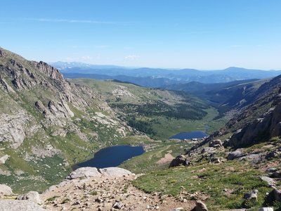
Chicago Lakes Trail #52
12.2 mi 19.6 km • 3,159' Up 962.92 m Up • 3,159' Down 962.93 m Down
Georgetown, CO

 Intermediate
Lair o' the Bear Out and Back
6.8 mi 11.0 km • 1,202' Up 366.31 m Up • 1,201' Down 366.15 m Down
Genesee, CO
 Difficult
Mount Rosa via Pipeline Trail
14.8 mi 23.8 km • 3,981' Up 1213.37 m Up • 3,983' Down 1214.09 m Down
Manitou…, CO
 Easy/Intermediate
Garden of the Gods Inner Loop
1.3 mi 2.1 km • 134' Up 40.95 m Up • 135' Down 41.04 m Down
Colorad…, CO
 Intermediate/Difficult
Mule Deer and Coyote Trail Loop
5.7 mi 9.2 km • 871' Up 265.55 m Up • 839' Down 255.63 m Down
Central…, CO
 Easy/Intermediate
Caribou Ranch
4.8 mi 7.7 km • 353' Up 107.58 m Up • 365' Down 111.12 m Down
 Intermediate
Mestaa'ėhehe Mountain
2.2 mi 3.5 km • 570' Up 173.68 m Up • 569' Down 173.29 m Down
 Intermediate/Difficult
Beartrack Lakes Loop
12.2 mi 19.6 km • 2,381' Up 725.62 m Up • 2,388' Down 727.84 m Down
Idaho S…, CO

 Easy
Easy
Highline Canal Trail
61.3 mi 98.7 km • 369' Up 112.41 m Up • 468' Down 142.66 m Down
Roxboro…, CO
 Easy/Intermediate
Sand Dunes Loop
3.6 mi 5.8 km • 301' Up 91.6 m Up • 309' Down 94.12 m Down
Crestone, CO
 Intermediate
Mays Peak Ramble via Penrose Trail (#665)
5.7 mi 9.2 km • 794' Up 241.88 m Up • 814' Down 248.25 m Down
Colorad…, CO
 Intermediate
Jim Creek Trail
7.7 mi 12.3 km • 1,390' Up 423.53 m Up • 1,389' Down 423.48 m Down
Winter…, CO
 Intermediate
Horsethief Falls
2.9 mi 4.6 km • 639' Up 194.77 m Up • 646' Down 196.89 m Down
 No Photos
Easy/Intermediate
No Photos
Easy/Intermediate
Blue Sky Out and Back
3.9 mi 6.3 km • 461' Up 140.5 m Up • 460' Down 140.31 m Down
Winter…, CO
 Difficult
Humboldt Peak
11.2 mi 18.1 km • 4,164' Up 1269.18 m Up • 4,166' Down 1269.76 m Down
 Intermediate/Difficult
Marion Mine
3.9 mi 6.3 km • 889' Up 271.02 m Up • 886' Down 270.01 m Down
Colorad…, CO
 Intermediate
South Mesa Loop
3.1 mi 5.0 km • 508' Up 154.7 m Up • 507' Down 154.43 m Down
 Intermediate
Rock Park Loop
1.4 mi 2.2 km • 302' Up 92.06 m Up • 313' Down 95.4 m Down
 Intermediate
Almagre Mountain via FSR 379
15.8 mi 25.5 km • 2,535' Up 772.76 m Up • 2,535' Down 772.61 m Down
Fort Ca…, CO
 Intermediate
Paramount Point to Bear Creek Trail Loop
2.7 mi 4.3 km • 622' Up 189.71 m Up • 616' Down 187.79 m Down
Kittredge, CO

 Intermediate/Difficult
Broome Hut via Second Creek Trail
2.0 mi 3.2 km • 714' Up 217.5 m Up • 714' Down 217.6 m Down
Winter…, CO
 Easy/Intermediate
The Brother
1.2 mi 1.9 km • 305' Up 92.89 m Up • 304' Down 92.79 m Down
No Photos
Intermediate/Difficult
Yankee Doodle Trail
4.0 mi 6.5 km • 723' Up 220.44 m Up • 723' Down 220.33 m Down
Fraser, CO
 Easy
Easy
City Park Loop
3.3 mi 5.3 km • 56' Up 17.05 m Up • 55' Down 16.88 m Down
No Photos
Difficult
Pinball Ridge
5.9 mi 9.4 km • 687' Up 209.51 m Up • 687' Down 209.44 m Down


