Hiking Project Logo

This is an easy 1-mile loop.


Your Rating: Rating Rating Rating Rating Rating      
Your Difficulty:
Your Favorites: Add To-Do · Your List
Zoom in to see details
Map Key

1.1

Miles

1.8

KM

Loop

395' 120 m

High

324' 99 m

Low

78' 24 m

Up

75' 23 m

Down

3%

Avg Grade (1°)

8%

Max Grade (4°)

Dogs Unknown

Features Birding · Geological Significance · Wildlife

Since this trail is in the mining area, there is a fee to hike. Mineral collecting is not permitted along this trail.

Description

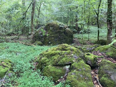
This trail starts on the outskirts of the mining area. According to the number signs, the trail appears to travel in a counterclockwise direction. It travels along a crushed gravel path around the 3 hills, and ends back at the loop split.

Flora & Fauna

Flora: Ironwood, Christmas Fern.
Fauna: Deer, Copperhead Snake.

Shared By:

David Smith

Trail Ratings

  3.0 from 1 vote

#43534

Overall
  3.0 from 1 vote
5 Star
0%
4 Star
0%
3 Star
100%
2 Star
0%
1 Star
0%
Trail Rankings

#473

in Arkansas

#43,534

Overall
0 Views Last Month
0 Since Jul 9, 2024
Easy/Intermediate Easy/Intermediate

0%
100%
0%
0%
0%
0%

Photos

Moss-covered rocks, on a misty day.
Jul 9, 2024 near Murfree…, AR

0 Comments

6,000 characters
6,000 characters

Weather


Current Trail Conditions

Unknown
Add Your Check-In

Check-Ins

Jul 8, 2024
David Smith
4.8mi — 1h 49m
PrevNext
March 2025
SuMoTuWeThFrSa
      1
2345678
9101112131415
16171819202122
23242526272829
3031     
Welcome

Join the Community! It's FREE

Already have an account? Login to close this notice.