
 Continue with onX Maps
 Sign in with Facebook


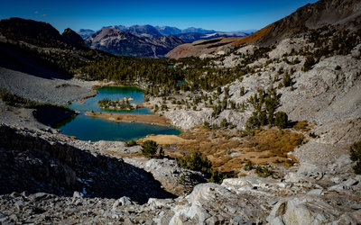
 Particularly Special Place


Newest Recommended Hiking Routes
near Sultana, California
Sultana, California 
Recommended Routes, Photos, & More


 Difficult
Hilton Lakes
11.5 mi 18.5 km • 2,372' Up 722.91 m Up • 2,371' Down 722.64 m Down

 Difficult
Sixty Lakes Basin Out and Back
30.4 mi 49.0 km • 7,981' Up 2432.52 m Up • 7,980' Down 2432.33 m Down

 Intermediate/Difficult
Druid Stones Lollipop Loop
5.1 mi 8.1 km • 2,014' Up 613.96 m Up • 2,012' Down 613.3 m Down

 Intermediate
Shadow and Ediza Lakes
14.2 mi 22.9 km • 1,667' Up 508.09 m Up • 1,669' Down 508.58 m Down
Mammoth…, CA
Intermediate/Difficult
1000 Island Lake Loop
18.7 mi 30.1 km • 3,205' Up 976.92 m Up • 3,213' Down 979.24 m Down
Mammoth…, CA
 Intermediate/Difficult
Jennie Lake Out and Back
13.9 mi 22.4 km • 2,428' Up 739.95 m Up • 2,427' Down 739.66 m Down
Three R…, CA

 Very Difficult
Darwin Bench Loop
16.2 mi 26.0 km • 4,838' Up 1474.53 m Up • 4,818' Down 1468.6 m Down
West Bi…, CA
 Difficult
Golden Trout Lake
4.4 mi 7.1 km • 2,200' Up 670.48 m Up • 2,199' Down 670.17 m Down
 Intermediate
Big Pine Lakes
13.1 mi 21.2 km • 3,182' Up 969.82 m Up • 3,171' Down 966.46 m Down
Big Pine, CA
 Very Difficult
Shepherd Pass Out-And-Back
21.5 mi 34.6 km • 6,937' Up 2114.54 m Up • 6,935' Down 2113.65 m Down
Lone Pine, CA
 Intermediate/Difficult
Monarch Lakes
10.0 mi 16.1 km • 2,808' Up 855.74 m Up • 2,803' Down 854.32 m Down
Three R…, CA
 Intermediate/Difficult
Chocolate Lakes Loop
6.8 mi 11.0 km • 1,601' Up 488.03 m Up • 1,602' Down 488.3 m Down
 Big Pine, CA
 Intermediate/Difficult
Bishop Pass Trail to Dusy Basin
17.5 mi 28.2 km • 4,404' Up 1342.28 m Up • 4,401' Down 1341.54 m Down
Big Pine, CA
 Difficult
Panorama Trail: Glacier Point to Happy Isles
8.8 mi 14.1 km • 1,255' Up 382.63 m Up • 4,438' Down 1352.81 m Down
Yosemit…, CA
 Difficult
Tungsten Peak
2.1 mi 3.4 km • 1,256' Up 382.94 m Up • 1,256' Down 382.93 m Down
West Bi…, CA

 Easy/Intermediate
Devils Postpile Short Loop
1.3 mi 2.1 km • 217' Up 66.16 m Up • 217' Down 66.08 m Down
Mammoth…, CA
 Intermediate/Difficult
East Lake from Roads End
25.5 mi 41.1 km • 4,580' Up 1395.98 m Up • 4,580' Down 1395.88 m Down
Squaw V…, CA

 Easy
Easy
Bishop Canal Loop
3.1 mi 4.9 km • 34' Up 10.32 m Up • 34' Down 10.39 m Down
Bishop, CA
 No Photos
Intermediate/Difficult
No Photos
Intermediate/Difficult
Cedar Grove Overlook via Hotel Creek
4.5 mi 7.2 km • 1,486' Up 452.93 m Up • 1,486' Down 452.83 m Down
Squaw V…, CA
 Intermediate
Alder Creek Falls
7.3 mi 11.8 km • 1,137' Up 346.41 m Up • 1,138' Down 346.82 m Down
Midpines, CA
 Intermediate
Duck Lake
7.7 mi 12.5 km • 1,679' Up 511.65 m Up • 1,678' Down 511.59 m Down
Mammoth…, CA
 Difficult
Cirque Lake via South Fork Cottonwood Creek
10.1 mi 16.3 km • 1,341' Up 408.8 m Up • 1,341' Down 408.73 m Down
Lone Pine, CA
 Intermediate
Kearsarge Pass Out and Back
9.6 mi 15.4 km • 2,571' Up 783.79 m Up • 2,570' Down 783.26 m Down
Lone Pine, CA
Intermediate/Difficult
Kearsarge Lakes and Bullfrog Lake
14.6 mi 23.6 km • 3,847' Up 1172.64 m Up • 3,846' Down 1172.16 m Down
Lone Pine, CA
Difficult
Cirque Lake Loop
23.0 mi 37.0 km • 3,756' Up 1144.8 m Up • 3,755' Down 1144.59 m Down
Lone Pine, CA
 Difficult
Hamilton Lakes Basin
31.1 mi 50.0 km • 7,108' Up 2166.61 m Up • 7,107' Down 2166.27 m Down
Three R…, CA
 Difficult
Mount Langley via New Army Pass
23.9 mi 38.5 km • 5,108' Up 1556.77 m Up • 5,108' Down 1556.8 m Down
Lone Pine, CA
 Intermediate/Difficult
Crabtree Pass Route
7.3 mi 11.8 km • 2,291' Up 698.36 m Up • 1,237' Down 376.96 m Down


