
 Continue with onX Maps
 Sign in with Facebook


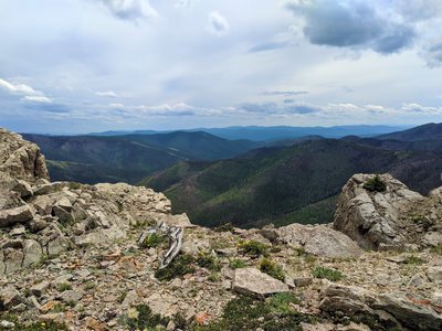
 Particularly Special Place


Newest Recommended Hiking Routes
near Raynesford, Montana
Raynesford, Montana 
Recommended Routes, Photos, & More

 No Photos
 Intermediate
Montana Trail Sec. 6 McDonald Pass to Homestake Pass
103.7 mi 166.8 km • 14,837' Up 4522.45 m Up • 14,797' Down 4510.24 m Down
 No Photos
Intermediate
No Photos
Intermediate
Montana Trail Sec. 5: Rogers Pass to McDonald Pass
71.5 mi 115.1 km • 14,122' Up 4304.3 m Up • 13,411' Down 4087.8 m Down
 Intermediate
Montana Trail Sec. 4: Benchmark to Rogers Pass
59.7 mi 96.0 km • 11,018' Up 3358.17 m Up • 10,651' Down 3246.31 m Down
 Intermediate
Montana Trail Sec. 16: Livingston to Lennep
97.0 mi 156.1 km • 10,073' Up 3070.2 m Up • 9,309' Down 2837.52 m Down
No Photos
Intermediate
Montana Trail Sec. 17: Lennep to Checkerboard
26.1 mi 42.1 km • 2,819' Up 859.22 m Up • 2,808' Down 855.93 m Down
 Intermediate
Montana Trail Sec. 19: Geyser to Highwood
40.4 mi 65.0 km • 4,415' Up 1345.58 m Up • 5,222' Down 1591.69 m Down
No Photos
Intermediate
Montana Trail Sec. 20: Highwood to Fort Benton
21.8 mi 35.1 km • 475' Up 144.77 m Up • 1,232' Down 375.39 m Down
No Photos
Intermediate
Montana Trail Sec. 21: Fort Benton to Kipps Landing
154.4 mi 248.5 km • 483' Up 147.13 m Up • 848' Down 258.59 m Down
No Photos
 Intermediate/Difficult
Montana Trail Sec. 18: Checkerboard to Geyser
86.4 mi 139.1 km • 11,176' Up 3406.53 m Up • 12,221' Down 3724.92 m Down
 Intermediate/Difficult
Limekiln Loop
6.4 mi 10.2 km • 1,300' Up 396.14 m Up • 1,285' Down 391.62 m Down
Lewistown, MT
 Difficult
Highwood Baldy Out-and-Back
6.2 mi 9.9 km • 3,191' Up 972.56 m Up • 3,191' Down 972.47 m Down


