
 Continue with onX Maps
 Sign in with Facebook


 Particularly Special Place


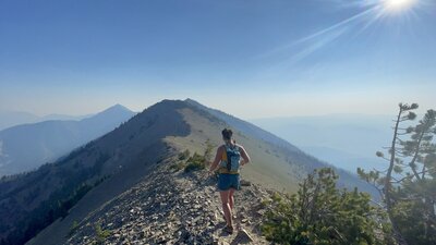
Bridger Range
 MT
MT- …Southwestern Montana
- Gallatin National Forest
- Bridger Range


Recommended Routes in Bridger Range - 9
Hiking Project is built by hikers like you. Add Your Recommended Routes

 Difficult
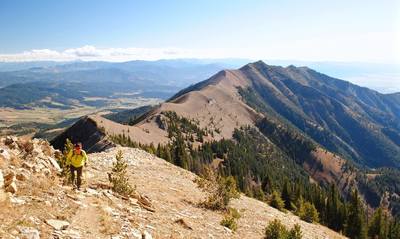
Bridger Ridge Traverse
18.7 mi 30.1 km • 4,060' Up 1237.47 m Up • 6,840' Down 2084.7 m Down
 Bozeman, MT
 Intermediate
Drinking Horse Mountain
2.3 mi 3.7 km • 643' Up 196.07 m Up • 643' Down 196.03 m Down
 Bozeman, MT
 Intermediate
Sypes Canyon Trail
6.4 mi 10.3 km • 1,599' Up 487.52 m Up • 1,599' Down 487.36 m Down
Bozeman, MT
 No Photos
 Intermediate/Difficult
Truman Gulch
4.8 mi 7.8 km • 1,281' Up 390.37 m Up • 1,282' Down 390.75 m Down
Bozeman, MT
 Difficult
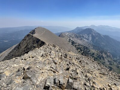
Sacagawea Peak
4.2 mi 6.8 km • 1,794' Up 546.91 m Up • 1,793' Down 546.43 m Down
Bozeman, MT
Difficult
Bridger Ridge Traverse 2.0 (M to Corbly)
25.9 mi 41.6 km • 8,533' Up 2600.99 m Up • 8,128' Down 2477.29 m Down
Bozeman, MT
 Difficult
Baldy Mountain
10.9 mi 17.6 km • 3,837' Up 1169.65 m Up • 3,837' Down 1169.42 m Down


Bridger Range Hiking
- 80 Miles 129 Kilometers of Trail
- 9 Recommended Routes
- 1
Easy Trail

- 19
Intermediate Trails

- 10
Difficult Trails

Weather Averages
|
High
|
Low
|
Precip
|
Days w/
|
| J | F | M | A | M | J | J | A | S | O | N | D |
Trails in Bridger Range - 21
Hiking Project is built by hikers like you. Add Your Trails
|
6.6
mi
10.6
km
#1Corbly Gulch Trail #544
Intermediate/Difficult
Bozeman, MT
|
Intermediate/Difficult
|
Bozeman, MT |
2
|
|
|
1.4
mi
2.2
km
#2Sacagawea Pass Trail #518
Difficult
Bozeman, MT
|
Difficult
|
Bozeman, MT |
7
|
|
|
2.4
mi
3.9
km
#3Ross Pass Trail #551
Intermediate
Bozeman, MT
|
Intermediate
|
Bozeman, MT |
1
|
|
|
11.1
mi
17.9
km
#4Bridger Ridge Trail #513
Difficult
Bozeman, MT
|
Difficult
|
Bozeman, MT |
1
|
|
|
19.9
mi
32.0
km
#5Bridger Foothills Trail #534
Difficult
Bozeman, MT
|
Difficult
|
Bozeman, MT |
4
|
|
|
3.2
mi
5.2
km
#6Sypes Canyon Trail #531
Intermediate
Bozeman, MT
|
Intermediate
|
Bozeman, MT |
4
|
|
|
1.2
mi
1.9
km
#7Middle Cottonwood
Intermediate
Bozeman, MT
|
Intermediate
|
Bozeman, MT |
8
|
|
|
1.5
mi
2.4
km
#8College M Trail #511
Intermediate
Bozeman, MT
|
Intermediate
|
Bozeman, MT |
10
|
|
0.8
mi
1.3
km
#9Fairy Lake Trail
 Easy/Intermediate
Bozeman, MT
|
Easy/Intermediate
|
Bozeman, MT |
2
|
|
|
1.9
mi
3.0
km
#10Drinking Horse Mountain Trail #515
Intermediate
Bozeman, MT
|
Intermediate
|
Bozeman, MT |
3
|
Photos of Bridger Range - 56
Hiking Project is built by hikers like you. Add Your Photos


