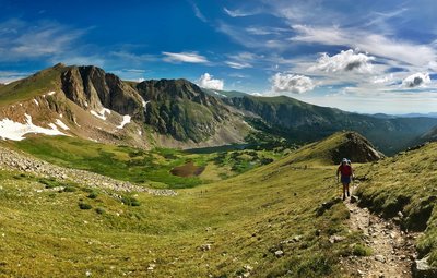
Winter Park and Fraser
Overview
Located just over an hour west of Denver and the Front Range, the town of Winter Park sits nestled into the Fraser River Valley. The steep drive up and over Berthound Pass that's required to access Winter Park, makes the town feel removed from the hustle and bustle of the I-70 corridor. The town is heavily invested in outdoor sports, especially mountain biking, with good reason.
Visiting Tips
Recommended Routes in Winter Park and Fraser - 9
Hiking Project is built by hikers like you. Add Your Recommended Routes


Byers Peak
8.9 mi 14.3 km • 2,818' Up 859.03 m Up • 2,818' Down 858.96 m Down


 Winter…, CO


Jim Creek Trail
7.7 mi 12.3 km • 1,390' Up 423.53 m Up • 1,389' Down 423.48 m Down


 Winter…, CO

 No Photos
Blue Sky Out and Back
3.9 mi 6.3 km • 461' Up 140.5 m Up • 460' Down 140.31 m Down


 Winter…, CO


South Fork Loop
3.8 mi 6.2 km • 329' Up 100.29 m Up • 329' Down 100.34 m Down


 Fraser, CO

 No Photos
Yankee Doodle Trail
4.0 mi 6.5 km • 723' Up 220.44 m Up • 723' Down 220.33 m Down


 Fraser, CO


Spruce Creek to Deadhorse Loop Trail
7.4 mi 12.0 km • 1,303' Up 397.3 m Up • 1,333' Down 406.17 m Down


 Fraser, CO


James Peak (13,294') from Corona Pass Road
8.6 mi 13.8 km • 2,102' Up 640.65 m Up • 2,101' Down 640.44 m Down


 Winter…, CO
Winter Park and Fraser Hiking
- 156 Miles 250 Kilometers of Trail
- 9 Recommended Routes
- 20
Easy Trails
- 49
Intermediate Trails
- 11
Difficult Trails
Areas Within Winter Park and Fraser
Weather Averages
|
High
|
Low
|
Precip
|
Days w/
|
| J | F | M | A | M | J | J | A | S | O | N | D |
Trails in Winter Park and Fraser - 71
Hiking Project is built by hikers like you. Add Your Trails
|
4.6
mi
7.4
km
#1CDT: South Boulder Creek to Rollins Pass
Winter Park, CO


|
Winter Park, CO |
2


|
||
|
0.3
mi
0.5
km
#2Marker Hill Vista Point
Fraser, CO


|
Fraser, CO |
1


|
||
|
2.2
mi
3.6
km
#3WTB Trail
Fraser, CO


|
Fraser, CO |
1


|
||
|
0.5
mi
0.8
km
#4Crater Lake Trail
Winter Park, CO


|
Winter Park, CO |
1


|
||
|
1.1
mi
1.8
km
#5Creekside Loop Trail
Fraser, CO


|
Fraser, CO |
1


|
||
|
1.0
mi
1.6
km
#6Serendipity
Fraser, CO


|
Fraser, CO |
2


|
||
|
0.8
mi
1.4
km
#7Betty & Bob Lakes Trail
Fraser, CO


|
Fraser, CO |
3


|
||
|
2.4
mi
3.9
km
#8Rogers Pass Trail
Winter Park, CO


|
Winter Park, CO |
3


|
||
|
5.7
mi
9.1
km
#9Tipperary Creek Trail #68
Fraser, CO


|
Fraser, CO |
4


|
||
|
2.2
mi
3.5
km
#10Flume
Fraser, CO


|
Fraser, CO |
3


|
Photos of Winter Park and Fraser - 93
Hiking Project is built by hikers like you. Add Your Photos

 Continue with onX Maps
 Sign in with Facebook


 Particularly Special Place


