
 Continue with onX Maps
 Sign in with Facebook


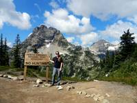
 Particularly Special Place


 Difficult
Difficult
Difficult
 Difficult
Land Manager: NPS - North Cascades National Park

 Lookout Mountain
8.7 mi 14.0 km • 4,330' Up 1319.68 m Up • 4,329' Down 1319.48 m Down


 Thunder Knob
3.7 mi 6.0 km • 677' Up 206.5 m Up • 677' Down 206.4 m Down
 Diablo, WA

 Maple Pass Loop
7.2 mi 11.5 km • 2,022' Up 616.17 m Up • 2,058' Down 627.39 m Down
Stehekin, WA
 Washington Pass Overlook
0.2 mi 0.4 km • 167' Up 50.8 m Up • 152' Down 46.43 m Down
Stehekin, WA
 Thornton Lakes Trail
10.3 mi 16.5 km • 3,076' Up 937.68 m Up • 3,078' Down 938.03 m Down
Diablo, WA
 Spider Gap - Buck Creek Pass Loop
43.3 mi 69.8 km • 9,095' Up 2772.1 m Up • 9,090' Down 2770.78 m Down
Stehekin, WA


0 Comments